


This is the next in the continuing series of posts from our recent trip to Prescott, AZ
Some locals told us about a nearby hike up Thumb Butte. It’s very close to Prescott — you can easily see the large granite formation from town. We were there during monsoon season and we got a late start. It was that time in the afternoon when the clouds began to gather and the rumbles from the distant thunder grew louder. We sat in the parking lot watching the clouds, listening to the thunder, and checking the local radar on our phones. After much deliberation, we decided to give it a shot. After all, what’s a little rain to someone from Seattle?
While the environs of the Pacific Northwest may have readied us for wet weather (which we never did see that day), living at an altitude between sea level and 350 feet did little to prepare us for the effects of elevation. We climbed from 5600 feet up to 6500 feet in less than a mile. Within just a few hundred yards from the trail head, we both needed to catch our breath. But we kept going and slowly paced our way up trail #33. The multitudes of switchbacks offered expansive panoramic vistas, each one more dramatic than the last.
Most of the clouds had dissipated and the sun had emerged by the time we reached the top. The return loop of the trail sloped down much more gradually. So we decided to take a slight detour, and took a longer route (trail #314 to #326, which you can see on this downloadable map). As we descended, so did the sun, making for more dramatic shots of the land around us.
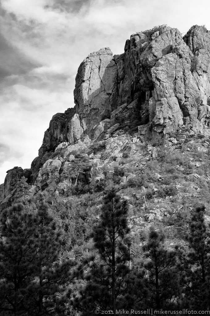
The photo below shows the granite outcroppings that give Thumb Butte its name.
Beautiful photo! It’s so crisp.
Thanks!
I guess we’re in no doubt as to what ‘Thumb Butte’ resembles! We’ve got all sorts of self-evident place names downunder here in OZ too – courtesy of the early settlers! I guess they had more on their minds than what to call stuff!!
Hah! No kidding!